Geology & Landcover
What makes Old Park so special?
Old Park & Chequers Wood form a very special part of the Stour Valley landscape between the ancient city of Canterbury and the internationally recognised wetland of Stodmarsh. Due to its geology, the site boasts the oldest excavatable site of human habitation in the country and the third oldest in Northern Europe, much of which still remains to be discovered. Today, the site features a diverse natural landscape which is rich with rare species of flora and fauna. The maps featured in this website help to tell the fascinating history of Old Park & Chequers Wood.
The Geology of Old Park & Chequers Wood
Old Park & Chequers Wood are a precious semi-natural landscape that form an important connecting bridge between the centre of Canterbury and open countryside. To fully understand why it is so unusual and important, it helps to deconstruct its component parts, namely its geology and landform, both of which have largely determined the landscape that we experience today.
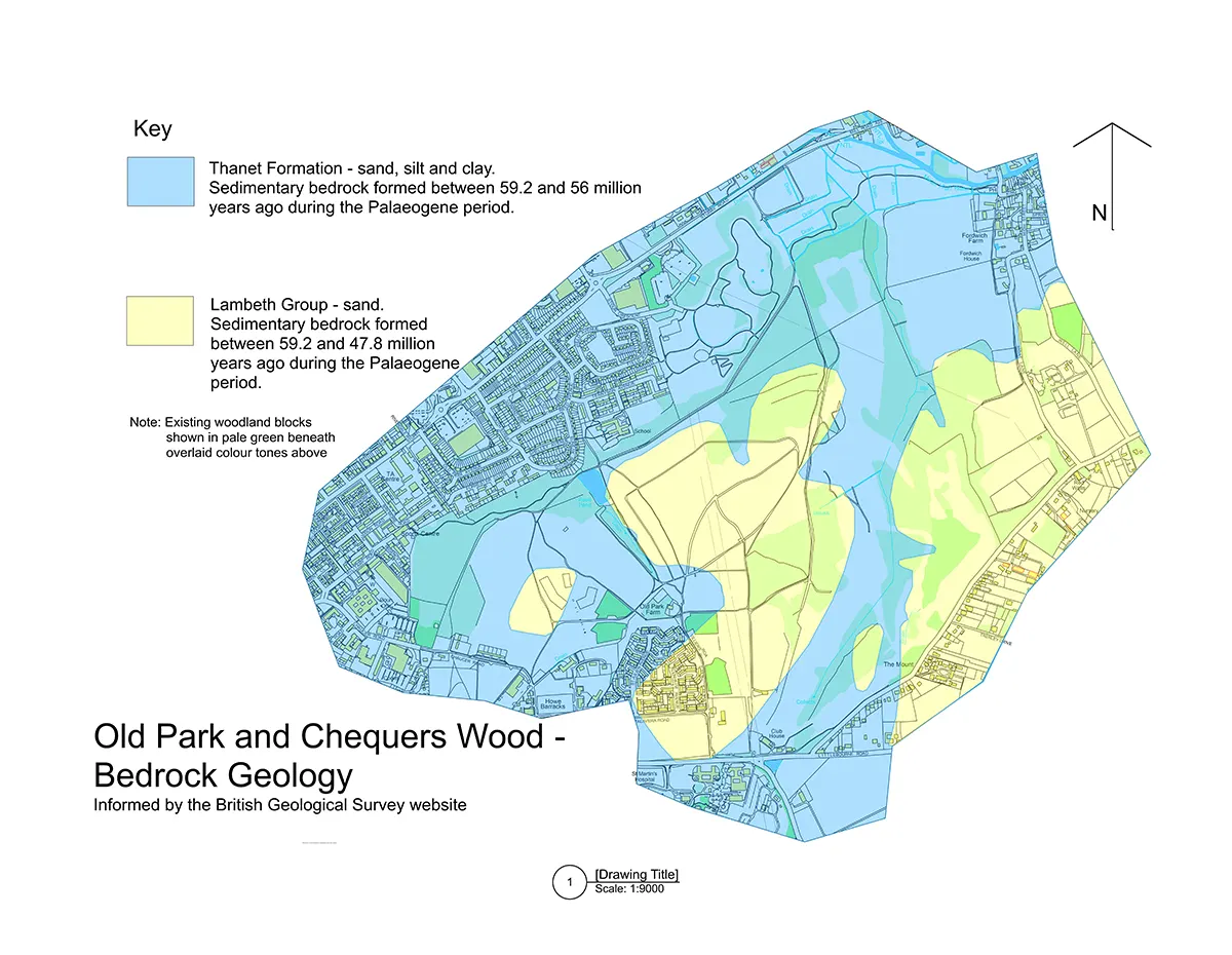
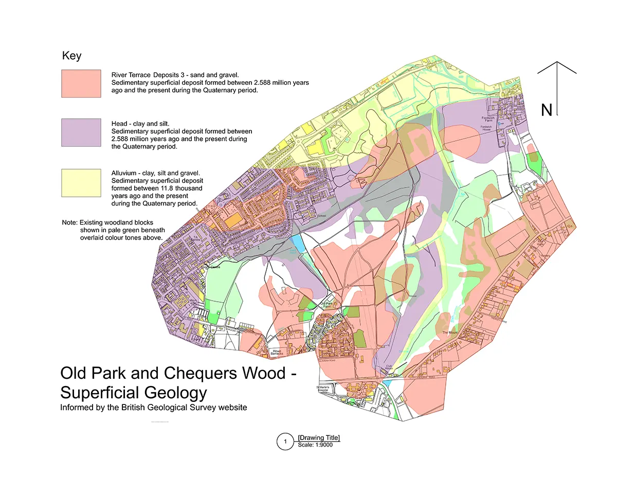
As shown in the first two maps below, the underlying geology of the site was formed over 50 million years ago. The bedrock is composed mainly of sedimentary Thanet beds, while the more recent superficial covering geology is a mix of River Terrace Gravels, Head clay and silt and alluvium.


The Landform of Old Park & Chequers Wood
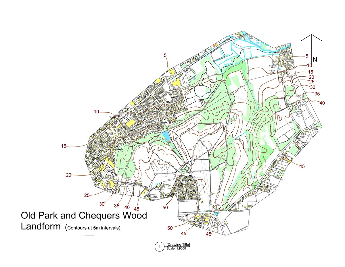
The landform of Old Park & Chequers Wood is extraordinary in that it differs markedly from the surrounding landscape which is largely flat. The map below shows that the land rises steeply from the river Stour corridor up to Littlebourne Road by 40-45m in a distance of just over 2000m. It is a topography of abrupt undulations, an irregular landform incised by steep valleys which contrast with a very open central plateau.
Coarse, free-draining, thin acidic sand and gravel soils make up most of the higher ground while base-rich peaty, alluvial soils are found in the lower valleys, some of which contain water courses emanating from natural springs.

Landcover on Old Park & Chequers Wood
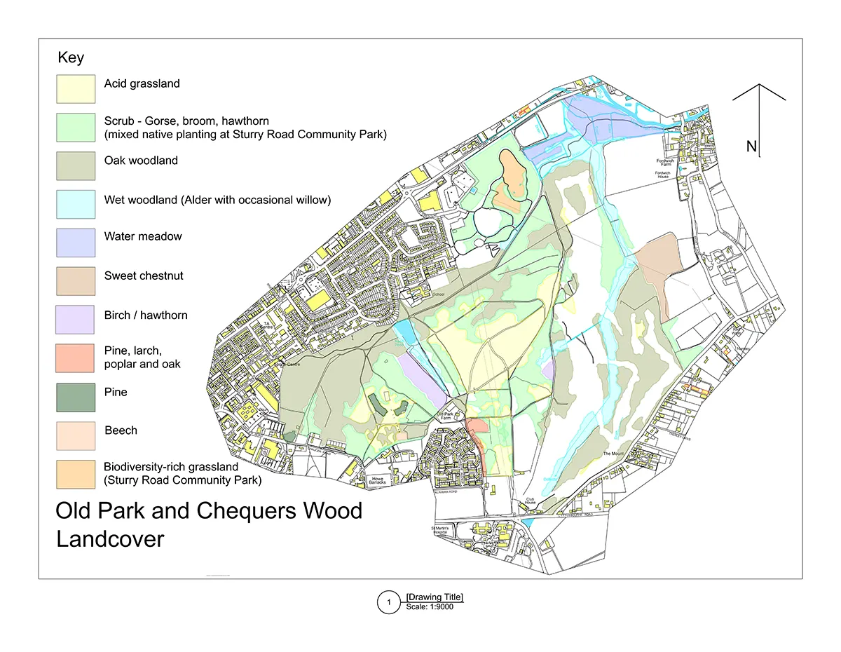
The Landcover map shows how the geology and soils have influenced the distribution of plant species across the landscape. Acid grassland with its assemblage of rare plant species is found on the higher sand and gravel plateau while dry oak woodland predominates on the sand and gravel valley slopes. Wet alder carr woodland is found in the very bottom of valleys, typically close to watercourses where the soil is more alkaline, peaty and alluvial.

Nature Recovery on a Landscape-scale
The variety and random disposition of the underlying geology and soils, combined with the unusual landform, provide the matrix for colonisation by a diverse range of plants and animal life searching to exploit the many different niches on offer. Due to the fact that Old Park escaped any kind of intensive use or agricultural ‘improvement’ involving cultivation, fertilisers or herbicides, it has remained a relatively untouched semi-natural landscape since time immemorial. Land such as this, close to an urban centre, is something which is increasingly rare and very special today.
All of the maps on this website show Old Park in association with the adjoining sites of Sturry Road Community Park, Canterbury Golf Course and Fordwich water meadows. Our vision is to create a landscape-scale greenspace of over 200 hectares, with coordinated management, to support the recovery of nature and the attainment of the Government’s 30 x 30 target (an international commitment to ensure that 30% of the UK’s land and seas are protected and managed for nature by 2030).
The Canterbury District Biodiversity Plan and the Nature Recovery Strategy for Kent & Medway are both expected to show Old Park as a key part of the nature recovery ‘jigsaw’ at the district and county level, linking up woodlands and wetlands along the Stour Valley.